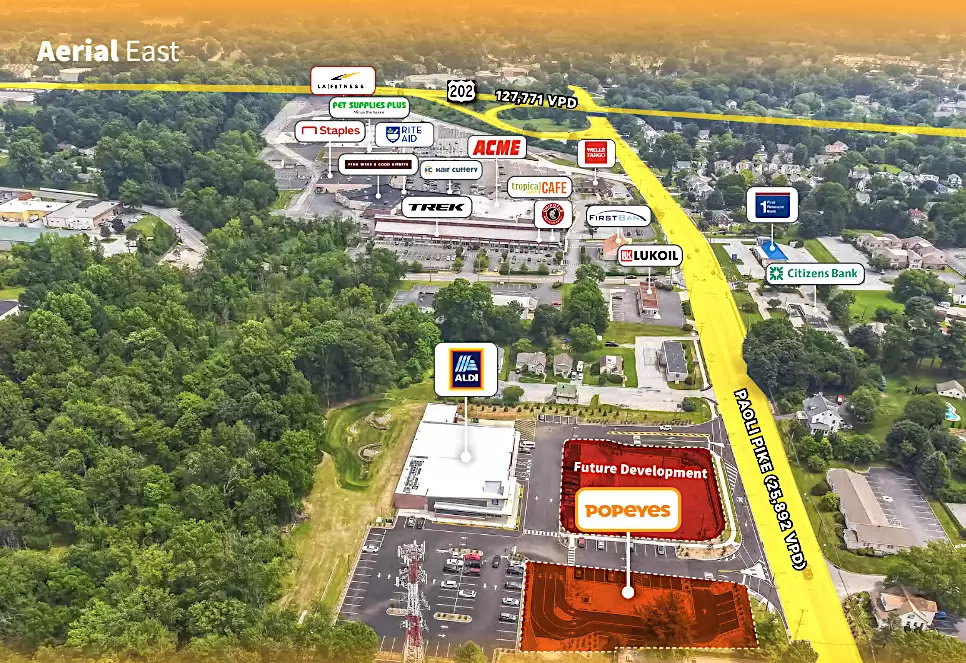
Popeyes is strategically positioned with excellent visibility as a street-facing outparcel to a newly constructed ALDI grocery store on Paoli Pike, which has a daily traffic count of 25,892 vehicles. Continuing westward, Paoli Pike transitions into Gay Street, which serves as the primary road leading into downtown West Chester, located just 1 mile away. Gay Street sees a traffic count of...
Popeyes is strategically positioned with excellent visibility as a street-facing outparcel to a newly constructed ALDI grocery store on Paoli Pike, which has a daily traffic count of 25,892 vehicles. Continuing westward, Paoli Pike transitions into Gay Street, which serves as the primary road leading into downtown West Chester, located just 1 mile away. Gay Street sees a traffic count of 18,188 vehicles per day. The subject property is surrounded by a variety of major retailers including ALDI, ShopRite, LA Fitness, Chipotle, Wawa, Citizens Bank, and more. Within close proximity, the property is less than a mile from the Chester County Hospital, as well as B. Reed Henderson High School and Fern Hill Elementary School. Additionally, it is less than 2 miles away from West Chester Friends School, Fugett Middle School, East High School, and West Chester University, which is the sixth largest university in Pennsylvania. Conveniently, the property is less than half a mile from on/off ramps to Route 202/West Chester Bypass, a major thoroughfare with a traffic count of 127,771 vehicles per day. This provides easy access throughout Southeastern Pennsylvania. The 5-mile trade area is supported by 117,560 residents earning an annual average household income of $165,631. West Chester, Pennsylvania is a borough located in Chester County, in the southeastern part of the state. It is known for its charming downtown area, historic architecture, and vibrant community. West Chester is located approximately 23 miles west of Philadelphia.


